
Karina becomes a Pacific hurricane well away from land and is forecast to become a major storm
Hurricane Karina formed in the eastern Pacific far from land and is expected to intensify into a major storm, while dangerous swells threaten parts of Mexico's coast.
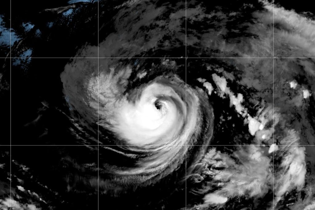
Hurricane Karina has formed in the eastern Pacific Ocean well away from land and is forecast to strengthen into a major storm, according to the National Hurricane Center. The system, which intensified from a tropical storm on Sunday, is not expected to make landfall, but forecasters warned that its swells could create hazardous surf and rip currents along parts of southwest Mexico and the Baja California Peninsula.
Karina was located hundreds of miles off the Mexican coast, moving in a direction that keeps it over open water for the foreseeable future. The hurricane center said the storm had reached hurricane strength and that conditions in the region remain favorable for rapid intensification. Forecasters project Karina could reach major hurricane status within the next couple of days, meaning winds of at least 111 mph, before it begins to weaken over cooler waters.
While the storm itself poses no direct threat to land, the hurricane center emphasized that the swells generated by Karina are likely to spread toward the coast of Mexico. Beachgoers and mariners along the affected areas were advised to monitor conditions closely, as rip currents can be deadly even when a storm remains far offshore. The Baja California Peninsula and the mainland coast of southwest Mexico are the areas most likely to see the effects.
The formation of Karina adds to an active hurricane season in the eastern Pacific, where warm ocean temperatures have fueled several named storms. Meteorologists have been tracking the system for days, noting that it organized quickly once it moved into an area of low wind shear and warm water. The storm's rapid development is consistent with forecasts that called for it to become a hurricane after it was designated a tropical storm.
Residents in coastal communities from southern Mexico to the southern tip of Baja California are being urged to stay alert for changing surf conditions even though no watches or warnings have been issued for land. The hurricane center said the primary hazard from Karina will be the ocean swells, which can travel long distances from the storm's center and affect beaches hundreds of miles away.
Forecasters will continue to track Karina as it moves across the Pacific, with the expectation that it will remain far from land throughout its life cycle. The storm is the latest in a series of systems to develop in the basin this year, and its intensification underscores the potential for powerful hurricanes to form quickly in the region during the peak of the season.
78